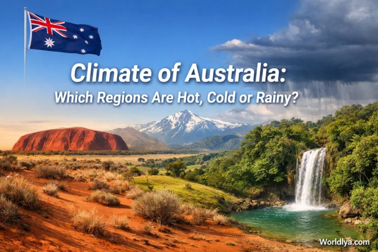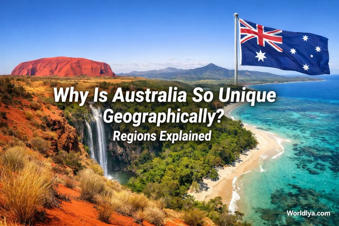
Australia looks simple on a classroom map: one vast landmass between the Indian and Pacific oceans. Read the terrain more closely and that simplicity disappears. Off the northeast sits the world’s largest coral reef ecosystem. Across the interior, deserts and semi-arid plains dominate. The southeast rises into alpine country, while the far north shifts into monsoonal tropics and rainforest pockets. Few places fit that much contrast into one country-sized landmass. That contrast is why Australia feels so unusual geographically.
The short version is this: Australia is old, dry, wide, isolated, and heavily shaped by long erosion rather than very high young mountain building. Once you see those five ideas together, its regions start to make sense.
Technical Snapshot
| Measure | Current Or Standard Figure | Why It Matters |
|---|---|---|
| Total Area | 7,688,287 km² | Explains the huge spread of climates and landforms |
| Population Density | 3.5 people per km² | Shows how empty the interior feels compared with the coasts |
| Major Climate Classes | 6 major Köppen classes, 28 sub-classes | One map does not equal one climate |
| Bioregions | 89 bioregions, 419 subregions | Helps explain why habitats change so sharply |
| Mainland Deserts | 10 named deserts, nearly 20% of Australia | The dry interior is not a small side note |
| Outback / Rangelands | About 81% of the country | The inland landscape is far bigger than many visitors expect |
| Inland-Draining Rivers | About 50% of rivers drain inland | Water often ends in salt lakes, not the sea |
| Highest Mainland Peak | Mount Kosciuszko, 2,228 m | Australia has mountains, but not Himalayan-style relief |
| Great Artesian Basin | Almost 1.7 million km² | Groundwater changes how inland Australia works |
| Great Barrier Reef Marine Park | 344,400 km², about 2,300 km long | A marine region on the scale of a country |
What Makes Australia So Distinct on the Map
- Deep geological age. Parts of Australia hold some of Earth’s oldest known zircon crystals, dated to 4.4 billion years.
- Long isolation. Australia drifted away and kept moving north, at roughly 7 centimetres a year.
- A dry interior. The country is the driest inhabited continent, and about 70% of it is arid or semi-arid land.
- Sharp coastal contrast. The wettest, greenest, and most densely settled belts sit mostly around the edges.
- An unusual water story. Many rivers do not run cleanly to the sea; a large share drains inward.
- Regional variety. Coral reef, savanna, desert, temperate coast, alpine high country, karst plain, and rainforest all appear within the same national map.
That mix gives Australia a strange visual rhythm. Fly across the country and the land can switch from reef-fringed coast to tablelands, then to red interior basins, then back to a temperate shoreline. It is less like one repeated landscape and more like a set of large geographic worlds joined on one plate.
A useful way to read the map: many textbooks talk about three broad landform divisions — the Western Plateau, the Central Lowlands, and the Eastern Highlands. For daily life, it also helps to treat the coastal belts as their own practical zone, because they explain rainfall, ports, farming, and where most large cities grew.
The Three Broad Landform Divisions — and the Coastal Belts
The Western Plateau
The Western Plateau covers much of the west and centre-west. This is ancient country: hard rocks, old shields, broad tablelands, and vast dry spaces shaped by time, not by very recent uplift. The Pilbara and Yilgarn are famous for their age. The Great Sandy, Gibson, and Great Victoria deserts help give the interior its red, open look. Near the western side of the continent, the Jack Hills preserve zircons that reach back 4.4 billion years, which is one reason Australia often appears in conversations about the earliest Earth.
This region is also where Australia’s age becomes visible to the naked eye. You see it in weathered rock forms, long escarpments, laterite surfaces, salt lake systems, and isolated massifs. Uluru and Kata Tjuta are not random desert monuments; they are reminders of a very long geological story written in sandstone, uplift, burial, and erosion.
- Best-known traits: shield rocks, deserts, mesas, salt lakes, isolated rock forms
- Why it matters: this is the engine behind Australia’s “ancient land” image
- Easy mental picture: big sky, wide surfaces, long distances, sparse drainage
The Central Lowlands
The Central Lowlands sit between the western and eastern high country. Think of this zone as a chain of low-lying plains and basins rather than one flat sheet. It includes parts of the Gulf plains, the Lake Eyre Basin, and the lowlands linked with the Murray-Darling system in the southeast. Some places are broad and open. Others are flood-prone after distant rain. This is one reason inland Australia can look dry for months, then suddenly hold water across huge areas.
Below much of this region lies one of Australia’s most remarkable geographic systems: the Great Artesian Basin. It spans almost 1.7 million km², underlies parts of Queensland, New South Wales, South Australia, and the Northern Territory, and stores an enormous volume of groundwater. That underground water has shaped settlement, inland industry, springs, and town life far beyond what the surface map alone would suggest.
This is also the country of inland drainage. About half of Australia’s rivers drain inward and often end in ephemeral salt lakes. The famous Finke River, in central Australia, is often described as one of the world’s oldest rivers. That gives the lowlands a character you do not get from a simple “plain” label.
The Eastern Highlands
The Eastern Highlands form the long raised spine of eastern Australia. The best-known element is the Great Dividing Range, which runs along the east and acts as a major drainage divide. It does not look like one unbroken wall. Instead, it behaves more like a long system of ranges, plateaus, tablelands, escarpments, and uplands. That subtlety matters. On a map it can look neat. On the ground, it is varied and uneven.
This region explains a lot: why eastern Australia has better-watered belts, why river systems split east and west, why the southeast has alpine country, and why major farming and urban zones grew where they did. Australia’s highest mainland peak, Mount Kosciuszko, reaches 2,228 metres. That is modest by world mountain standards, yet high enough to create snow country, cool uplands, and a striking contrast with the inland plains.
- Best-known traits: Great Dividing Range, tablelands, escarpments, alpine southeast
- Why it matters: rainfall, river direction, farming belts, and settlement all change here
- Easy mental picture: a long elevated edge shaping the east side of the continent
The Coastal Belts and Tasmania
If you want to understand how Australians actually experience the map, the coastal belts deserve their own spotlight. The east coast includes humid stretches, estuaries, beaches, river mouths, and reef-linked margins. The south and southwest include temperate and Mediterranean-style seasonal patterns. The tropical north shifts into savanna and wet-dry rhythms. Then there is Tasmania, which brings a cool maritime feel, rugged relief, and highland weather that can feel worlds away from the Red Centre.
This coastal emphasis also helps explain the population map. Australia’s national population density is low, yet many major urban centres sit on or near the coast because that is where access, rainfall, ports, and milder conditions are easier to combine.
Climate Regions That Redraw the Same Map
The Bureau of Meteorology divides Australia into 6 major climate classes and 28 sub-classes using the Köppen system. That matters because climate does not neatly follow state lines. It follows latitude, elevation, distance from the sea, and the position of the highlands.
- Equatorial: tiny far-northern pockets with year-round heat and high moisture
- Tropical: the Top End and parts of the north, with strong wet and dry seasons
- Subtropical: much of the east coast, where warmth and humidity stay important
- Desert: the interior core, where rainfall is low and evaporation is high
- Grassland / Steppe: the transitional margins around the deserts
- Temperate: much of the south, southeast, southwest, and Tasmania
There is also local alpine weather in the high southeast. That is the beauty of Australia’s climate map: one country, but several different ways of living on the land. A summer day in Darwin, Hobart, Alice Springs, and Cairns does not feel like four versions of the same place.
One simple way to remember it: the farther you move away from Australia’s wetter coastal rims and higher country, the more the map tends to open out into drier landscapes. That is why the interior feels so different from the edges.
Why Water Behaves Differently Here
Inland Drainage
About 50% of Australia’s rivers drain inland. In wet years, inland basins can spread across huge areas. In dry years, many channels shrink, break, or disappear into sand and salt flats.
The Eastern Divide
The Great Dividing Range separates many west-flowing inland rivers from shorter east-flowing coastal rivers. One long upland system changes the whole water map.
That water story is one of the clearest reasons Australia feels geographically different. In many countries, the basic expectation is simple: rivers cross the land and head to the coast. In Australia, that pattern often breaks. Surface water can be brief, irregular, and local. Groundwater can matter more than the dry surface suggests. Floods can also behave in two very different ways: slow, wide inland flooding across flat country, or fast river rises and flash flooding in mountain and coastal belts.
That is why phrases like Outback, channel country, dry riverbed, artesian spring, and salt lake are not fringe vocabulary in Australia. They describe the map as it really works.
Region-by-Region Character You Can Picture
Tropical North
The far north is hot, seasonal, and biologically varied. Monsoonal savannas, wetlands, rivers, and patches of rainforest make this region feel nothing like the red interior. The Wet Tropics of Queensland are especially striking because rainforest sits so close to reef and coast.
The East Coast and Reef Margin
Off the northeast coast, the Great Barrier Reef Marine Park covers 344,400 km² and stretches about 2,300 km. It includes around 3,000 coral reefs, 600 continental islands, 300 coral cays, and about 150 inshore mangrove islands. That is not just a tourist icon. It is a giant geographic zone tied to shelf waters, coastal processes, and the warm marine edge of northeastern Australia.
The South and Southwest
Southern Australia brings cooler, temperate conditions, productive coastal strips, and landscapes that can feel closer to Mediterranean or maritime environments than to the desert image many people expect. The Nullarbor Plain, though, reminds you that “south” does not always mean green. Its vast limestone surface and treeless horizon are among the most memorable plains on Earth.
The Red Centre
Central Australia is where outsiders often imagine the whole country. It is visually powerful, but it is only one piece of the map. Here you get sandstone domes, spinifex country, dune fields, dry channels, and long horizons. The colour palette alone — ochre, rust, pale grass, white salt — helps explain why this region leaves such a strong impression.
Why Australia Supports So Many Different Habitats
A lot of articles stop after naming mountains, deserts, and reef. That misses a bigger point. Australia is not only varied in scenery; it is also divided into 89 bioregions and 419 subregions. These are grouped using climate, geology, landform, native vegetation, and species patterns. Put plainly, the country changes in ways that are deeper than surface appearance.
- Australian Alps: cool high country with snow, alpine vegetation, and headwaters
- Wet Tropics: rainforest close to the sea in far northeastern Queensland
- Nullarbor Plain: a limestone plain with its own stark identity
- Rangelands: about 81% of Australia, mixing savanna, shrubland, woodland, and grassland across low-rainfall country
This is why Australia can look familiar in one photo and completely unfamiliar in the next. A reef margin, a karst plain, a monsoonal savanna, and alpine slopes are not small variations on one theme. They are different geographic worlds connected by one national outline.
Common Questions About Australia’s Geography
Is Australia Mostly Desert?
Not exactly. Ten named deserts make up nearly 20% of Australia, and about 70% of the country is arid or semi-arid. That is a lot of dry land, but it still leaves room for tropical, temperate, alpine, wetland, forest, and reef environments.
Where Are Australia’s Mountains?
Mostly in the Eastern Highlands, especially the Great Dividing Range, the Australian Alps, and related uplands. Australia has real mountain country, even if its highest elevations are lower than those on some other continents.
Why Do So Many People Live Near the Coast?
Because coastal belts usually offer better access, port locations, milder conditions, and more reliable rainfall than much of the interior. The inland map can be beautiful and productive, but it is often harder going.
Is the Outback the Same as the Desert?
No. The Outback broadly overlaps with the rangelands, which cover about 81% of Australia. That includes deserts, but also savannas, woodlands, shrublands, and grasslands.
What Is the Most Useful Way to Divide Australia Geographically?
Start with the Western Plateau, Central Lowlands, and Eastern Highlands. Then add the coastal belts as a practical overlay. That gives you both the classic physical map and the lived map.
Final Thought: Australia stands out geographically because its map is built from old rocks, wide dry interiors, strong coastal contrasts, unusual drainage, and a scale large enough to fit reef, rainforest, plateau, basin, savanna, plain, and alpine country into one place. That is not a small detail. It is the whole story.
Sources
- Geoscience Australia — Australian Landforms and Their History
- Geoscience Australia — Area of Australia
- Bureau of Meteorology — Climate Classification Maps
- Bureau of Meteorology — Australian Climate Zones
- DCCEEW — Australia’s Bioregions
- DCCEEW — Outback Australia: The Rangelands
- DCCEEW — Great Artesian Basin
- Great Barrier Reef Marine Park Authority — Great Barrier Reef Facts
- Australian Bureau of Statistics — Regional Population
- Geoscience Australia — Highest Mountains