
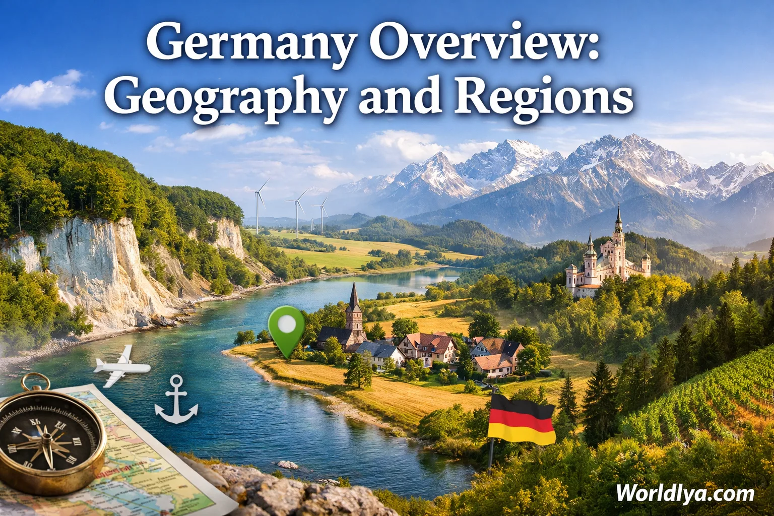
Germany stretches from the tidal coasts of the North Sea and Baltic Sea to the high ridges of the Bavarian Alps. Between those edges lies a country of river valleys, forested uplands, broad plains, lake districts, farming basins, and closely connected cities. The map may look compact, yet the scenery changes steadily as you travel. The simplest way to understand Germany is to see it as a gentle staircase rising from north to south.
Germany’s Geographic Profile
Position
Central Europe
Area
About 357,600 km²
Coasts
North Sea and Baltic Sea
Federal States
16 Länder
Germany shares land borders with nine countries: Denmark, Poland, Czechia, Austria, Switzerland, France, Luxembourg, Belgium, and the Netherlands. Its highest point is the Zugspitze at 2,962 metres, while its northern lowlands include areas close to sea level.
Where Germany Sits in Europe
Germany occupies a central position on the European mainland. This location helps explain why so many landscapes, river systems, regional identities, and transport routes meet within its borders. The country is neither purely northern nor purely Alpine. It belongs to both worlds, with a broad middle zone linking them.
The national territory measures roughly 876 kilometres from north to south and about 640 kilometres from west to east at its widest spans. Those figures are not enormous by continental standards, but they are large enough to create clear regional contrasts. A coastal morning in Schleswig-Holstein can feel very different from an afternoon beside an Alpine lake in Bavaria.
- North: Denmark, the North Sea, the Baltic Sea, marshes, islands, and open plains.
- West: the Rhine corridor, the Ruhr area, wooded hills, and close links with the Low Countries and France.
- Centre: low mountain ranges, forested ridges, basins, and old river towns.
- East: broad plains, lake country, the Elbe valley, and uplands along the Czech border.
- South: the Danube, Alpine foothills, large lakes, high plateaus, and the German Alps.
Reading the map from north to south is often more useful than thinking only in state boundaries. Elevation rises, coastlines give way to uplands, and the landscape becomes more Alpine near the southern edge.
Four Landscapes That Explain Germany
Geographers often divide Germany into four broad physical zones. The borders between them are not sharp lines. One landform gradually blends into another, especially around river valleys and basin edges.
1. The North German Plain
This low-lying zone covers much of northern Germany. It includes coastal marshes, sandy heathland, farmland, glacial ridges, lake districts, and wide river valleys. The land often feels open, with long horizons and fewer steep slopes.
2. The Central Uplands
The Mittelgebirge zone forms Germany’s broad middle belt. It contains rounded mountain ranges, wooded plateaus, volcanic areas, valleys, and sheltered basins. The Harz, Eifel, Hunsrück, Taunus, Thuringian Forest, Ore Mountains, and Black Forest belong to this wider upland system.
3. The Alpine Foreland
South of the Danube, rolling plateaus and glacial landforms lead toward the Alps. Lakes, pastureland, wooded hills, and distant mountain views shape much of this zone. It is especially visible across southern Bavaria and southeastern Baden-Württemberg.
4. The German Alps
Germany’s Alpine zone is narrow and lies entirely in Bavaria along the Austrian border. It includes the Allgäu Alps, Bavarian Prealps, and Berchtesgaden Alps. Sharp peaks, deep valleys, mountain lakes, and high meadows create the country’s most elevated scenery.
The North: Coasts, Islands, and Open Land
Northern Germany faces two different seas. The North Sea coast is shaped by tides, mudflats, dunes, dikes, estuaries, and offshore islands. The Baltic coast generally has weaker tides, more sheltered bays, cliffs in some areas, long beaches, and large islands.
The North Sea side includes the East Frisian Islands, the North Frisian Islands, and Heligoland farther offshore. Much of the coast borders the Wadden Sea, where the shoreline changes with the tide. The Baltic side includes islands such as Rügen, Usedom, and Fehmarn. Rügen is Germany’s largest island and is known for a varied coast of beaches, lagoons, woodland, and chalk cliffs.
What the Northern Plain Looks Like
- Coastal marshes: flat, fertile land near the sea, often protected by dikes.
- Geest: slightly higher, sandier ground formed by glacial deposits.
- Heathland: open landscapes such as the Lüneburg Heath.
- Lake country: glacial lakes across Mecklenburg-Western Pomerania and Brandenburg.
- River lowlands: broad valleys around rivers such as the Elbe, Weser, and Ems.
The north is not completely flat. The Harz rises near the southern edge of Lower Saxony and Saxony-Anhalt, while low glacial ridges break up the plains farther north. Still, compared with central and southern Germany, the overall sense is one of open space.
Central Germany: Ridges, Basins, and River Corridors
Central Germany is a patchwork rather than one continuous mountain chain. Forested ridges rise, fall, and open into basins where towns, farmland, and transport routes gather. These uplands are usually lower and rounder than the Alps, yet they shape the scenery strongly.
The Harz stands apart above the northern plains. The Thuringian Forest forms a long wooded ridge through central Germany. The Ore Mountains run along the border between Saxony and Czechia. Farther west, the Eifel, Hunsrück, Taunus, Westerwald, and Sauerland frame the Rhine and its tributaries. In the southwest, the Black Forest rises above the Upper Rhine Plain.
Rivers often provide the easiest route through this uneven land. The Rhine, Main, Moselle, Lahn, Neckar, Saale, and Werra have cut valleys that connect regions which would otherwise feel separated by uplands. Many well-known city corridors follow these lower, flatter passages.
A Useful Mental Map
Valleys hold many of the major routes. Ridges and forests sit between them. This is why a journey through central Germany may alternate quickly between busy river cities, quiet wooded slopes, open farmland, and compact historic towns.
The South: Plateaus, Lakes, and Alpine Peaks
Southern Germany is often associated with mountains, but much of the region is made of plateaus, river basins, low ranges, and rolling farmland. The Alps occupy only the far southern edge. Before reaching them, the landscape passes through the Swabian Jura, Franconian Jura, Bavarian Forest, Black Forest, Upper Rhine Plain, Danube valley, and Alpine foothills.
The Upper Rhine Plain forms a broad, relatively low corridor between the Black Forest and the Vosges Mountains in France. The Swabian Jura rises east of the Black Forest as a limestone plateau with cliffs, caves, and dry valleys. The Bavarian Forest lies along the Czech border and links naturally with the Bohemian Forest beyond Germany.
Farther south, the Alpine Foreland contains lakes left by past glaciation. Lake Constance lies at Germany’s southwestern corner and is shared with Austria and Switzerland. Bavaria’s foothill lakes include Chiemsee, Starnberger See, Tegernsee, and many smaller waters. On clear days, the Alps appear across the horizon long before the road reaches the mountains.
Zugspitze marks Germany’s highest point at 2,962 metres. It stands in the Wetterstein Mountains near the Austrian border. The summit is part of a broader Alpine zone that includes deep valleys, high meadows, clear lakes, and limestone peaks.
Germany’s 16 Federal States
Germany is divided into 16 federal states, called Länder in German. State boundaries matter for administration, education, regional planning, and local identity, but they do not always match physical landscapes. The Harz, Rhine Valley, and Lake Constance region all cross or touch more than one state.
| Federal State | Capital | Broad Position | Geographic Character |
|---|---|---|---|
| Baden-Württemberg | Stuttgart | Southwest | Black Forest, Upper Rhine Plain, Swabian Jura, Neckar Valley, and Lake Constance shore |
| Bavaria | Munich | Southeast | Danube basin, Franconia, Bavarian Forest, Alpine foothills, lakes, and Alps |
| Berlin | Berlin | Northeast | City-state within the lowlands of Brandenburg, shaped by rivers, canals, and lakes |
| Brandenburg | Potsdam | Northeast | Sandy plains, pine forest, wetlands, glacial lakes, and the Spree landscape |
| Bremen | Bremen | Northwest | Two-city state formed by Bremen and Bremerhaven along the Weser corridor |
| Hamburg | Hamburg | North | City-state on the Lower Elbe, with harbour basins, marshes, and river islands |
| Hesse | Wiesbaden | Central-West | Forested uplands, Rhine and Main valleys, Taunus, Vogelsberg, and northern basins |
| Lower Saxony | Hanover | Northwest | North Sea coast, East Frisian Islands, plains, heathland, Weser hills, and western Harz |
| Mecklenburg-Western Pomerania | Schwerin | Northeast | Baltic coast, islands, lagoons, farmland, and the Mecklenburg Lake District |
| North Rhine-Westphalia | Düsseldorf | West | Rhine corridor, Ruhr urban region, Münsterland, Eifel edge, Sauerland, and Teutoburg Forest |
| Rhineland-Palatinate | Mainz | Southwest | Rhine and Moselle valleys, Eifel, Hunsrück, Westerwald, Palatinate Forest, and vineyard slopes |
| Saarland | Saarbrücken | Southwest | Compact wooded hills and the Saar Valley near France and Luxembourg |
| Saxony | Dresden | East | Elbe Valley, Saxon Switzerland, Ore Mountains, Lusatia, and northern lowlands |
| Saxony-Anhalt | Magdeburg | East-Central | Elbe lowlands, fertile Börde plain, eastern Harz, river meadows, and open farmland |
| Schleswig-Holstein | Kiel | North | Land between the North Sea and Baltic Sea, with marshes, islands, fjord-like inlets, and lakes |
| Thuringia | Erfurt | Central | Thuringian Basin, Thuringian Forest, wooded ridges, and the upper Saale Valley |
Berlin, Bremen, and Hamburg are city-states. Bremen is unusual because the state consists of two separate urban areas: Bremen and the port city of Bremerhaven.
Regional Names Beyond State Borders
Visitors often encounter names that do not appear as official states. These may describe a landscape, historic area, urban zone, or cultural region. Their boundaries can be flexible, and two people may draw them slightly differently.
| Regional Name | Where It Is | What Defines It |
|---|---|---|
| The Rhineland | Western Germany along and near the Rhine | River cities, terraces, low uplands, vineyards in the south, and a shared Rhine identity |
| The Ruhr Area | North Rhine-Westphalia | A closely linked urban region around cities including Essen, Dortmund, Duisburg, and Bochum |
| Franconia | Mainly northern Bavaria | River valleys, limestone hills, forest, vineyards, and cities such as Nuremberg, Bamberg, and Würzburg |
| Swabia | Parts of Baden-Württemberg and Bavaria | Swabian Jura, Danube and Neckar landscapes, upland towns, and a strong regional identity |
| The Black Forest | Southwestern Baden-Württemberg | High wooded ridges, deep valleys, upland lakes, and slopes above the Upper Rhine Plain |
| The Harz | Lower Saxony, Saxony-Anhalt, and Thuringia | An isolated upland block rising above the northern plains |
| Lusatia | Eastern Brandenburg and Saxony | Heath, rivers, forests, lakes, and a regional identity spanning the German-Polish border area |
| The Mecklenburg Lake District | Mecklenburg-Western Pomerania | A dense network of glacial lakes, canals, forest, and quiet rural land |
| The Lake Constance Region | Germany’s far southwest beside Austria and Switzerland | A large shared lake, gentle shorelines, orchards, towns, and Alpine views |
| Saxon Switzerland | Southeastern Saxony | Sandstone cliffs, table mountains, deep ravines, and the Elbe Valley |
A regional name is not always an administrative label. “Black Forest,” “Rhineland,” and “Franconia” tell you more about landscape and identity than about formal boundaries.
Rivers, Lakes, and Drainage Basins
Water is one of the clearest ways to read Germany’s geography. Most major rivers flow toward the North Sea or Baltic Sea, while the Danube carries water east toward the Black Sea. Watersheds cross mountain ridges and divide the country into large drainage basins.
Major Rivers
- Rhine: flows north through western Germany and forms part of the southwestern border.
- Elbe: enters Saxony, passes Dresden, Magdeburg, and Hamburg, then reaches the North Sea.
- Danube: begins in the Black Forest region and flows east across southern Germany.
- Weser: forms at Hann. Münden and runs north to the North Sea.
- Oder: follows much of Germany’s eastern border before reaching the Baltic Sea system.
- Main: crosses Franconia and joins the Rhine near Mainz.
- Moselle: winds through the southwest before joining the Rhine at Koblenz.
Notable Lakes and Lake Regions
- Lake Constance: a large international lake on Germany’s southwestern edge.
- Müritz: the largest lake lying entirely within Germany.
- Chiemsee: Bavaria’s largest lake, set in the Alpine Foreland.
- Mecklenburg Lake District: a broad northern network of connected lakes and waterways.
- Holstein Switzerland: a hilly lake region in eastern Schleswig-Holstein.
- Bavarian foothill lakes: waters such as Starnberger See and Tegernsee near the Alps.
The Rhine is the best-known river corridor, but it is not the only one shaping settlement. The Elbe links southeastern and northern Germany. The Main creates an east–west route through Franconia and Hesse. The Danube ties together parts of Baden-Württemberg and Bavaria before continuing beyond Germany.
How Climate Varies Across Germany
Germany has a temperate climate, yet local conditions shift with distance from the sea, elevation, valley shape, and exposure to weather systems. There is no single “German climate” that feels the same everywhere.
| Zone | Typical Pattern | Places That Show It |
|---|---|---|
| North Sea and Baltic Coasts | Maritime influence, wind, milder winters, and summers moderated by the sea | Schleswig-Holstein, Lower Saxony coast, Mecklenburg-Western Pomerania |
| Western River Corridors | Generally moderate conditions, with sheltered valleys that may feel warmer than nearby uplands | Rhine, Main, Moselle, and Neckar valleys |
| Central Uplands | Cooler temperatures and more rain at higher elevations | Harz, Sauerland, Thuringian Forest, Black Forest |
| Eastern Lowlands | More inland influence, with warmer summer periods and colder winter spells than the coast | Brandenburg, Saxony-Anhalt, inland Saxony |
| Alpine Foreland and Alps | Cooler at height, wetter near mountain slopes, and greater chances of winter snow in elevated areas | Southern Bavaria and the Alpine edge |
Elevation can matter more than latitude. A forested summit in central Germany may be cooler and wetter than a low valley much farther south. The Upper Rhine Plain is one of the country’s milder lowland areas, while exposed peaks in the Harz, Black Forest, Bavarian Forest, and Alps can remain cool even when nearby towns are warm.
How Geography Shapes a Visit
Germany’s regional variety becomes easier to appreciate when a route follows the land rather than jumping between famous city names. A north-to-south journey shows the strongest contrast, while an east-to-west route reveals changing river systems, uplands, urban belts, and border landscapes.
Five Practical Geography-Based Routes
- Coast and islands: Schleswig-Holstein, Hamburg, the Lower Elbe, and the North Sea or Baltic islands.
- Lake country: Brandenburg and Mecklenburg-Western Pomerania, with forests, waterways, and small towns.
- Rhine corridor: Upper Rhine, Middle Rhine, Cologne area, and the lower river toward the Netherlands.
- Central uplands: Harz, Thuringian Forest, Rhön, or Black Forest, paired with nearby river valleys.
- Alpine south: Lake Constance, Bavarian foothill lakes, Allgäu, Garmisch area, or Berchtesgaden.
Distances can be deceptive. Germany’s major cities are well connected, but a mountain valley, island ferry, rural lake district, or winding upland road may take longer to reach than the map suggests. Coastal weather can also change quickly, and mountain conditions may differ from those in a nearby lowland city.
For a first visit, pairing one city region with one physical landscape creates a more rounded picture. Hamburg and the North Sea coast, Berlin and the Brandenburg lakes, Cologne and the Rhine Valley, Dresden and Saxon Switzerland, or Munich and the Alpine Foreland are natural combinations.
German Geography Terms Worth Knowing
| German Term | Meaning | Useful Context |
|---|---|---|
| Land / Länder | Federal state / federal states | Bavaria and Hesse are Länder; Berlin is both a city and a Land. |
| Stadtstaat | City-state | Berlin, Bremen, and Hamburg. |
| Mittelgebirge | Low or middle mountain range | Used for uplands such as the Harz and Black Forest. |
| Norddeutsches Tiefland | North German Plain | The broad lowland zone across northern Germany. |
| Alpenvorland | Alpine Foreland | The rolling lake and plateau country north of the Alps. |
| Küste | Coast | Used for the North Sea and Baltic Sea shores. |
| Insel | Island | Rügen, Fehmarn, and Sylt are islands. |
| See | Lake or sea, depending on context | Chiemsee is a lake; Nordsee means North Sea. |
| Fluss | River | Rhine, Elbe, and Danube are major rivers. |
| Tal | Valley | Common in regional and place descriptions. |
Frequently Asked Questions
Is Germany Mostly Flat or Mountainous?
Germany is both. The north is dominated by plains and low coastal land, the centre contains many forested uplands, and the far south reaches the Alps. Most of the country lies between the very flat north and the high Alpine edge.
How Many Regions Does Germany Have?
Germany has 16 official federal states. It also has many physical, historic, and cultural regions such as the Rhineland, Franconia, the Black Forest, the Ruhr area, and the Mecklenburg Lake District. These informal regions often cross state boundaries.
Which Part of Germany Has the Alps?
The German Alps lie in southern Bavaria along the Austrian border. The Alpine zone includes areas around the Allgäu, Garmisch-Partenkirchen, the Chiemgau Alps, and Berchtesgaden.
Does Germany Have Islands?
Yes. Germany has North Sea and Baltic Sea islands. Well-known examples include Sylt, Föhr, Borkum, Norderney, Heligoland, Rügen, Usedom, and Fehmarn.
What Is Germany’s Largest Island?
Rügen is Germany’s largest island. It lies in the Baltic Sea off the coast of Mecklenburg-Western Pomerania.
What Is the Highest Mountain in Germany?
The Zugspitze is Germany’s highest mountain at 2,962 metres. It stands in Bavaria near the Austrian border.