
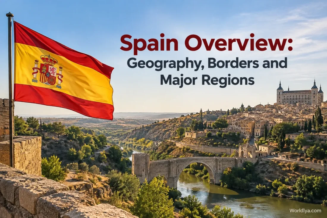
Spain occupies most of the Iberian Peninsula in southwestern Europe, yet the country extends well beyond the peninsula. Its territory also includes the Balearic Islands in the Mediterranean, the Canary Islands in the Atlantic Ocean, and the autonomous cities of Ceuta and Melilla in northern Africa. This spread gives Spain an unusually varied physical map: high plateaus, long mountain systems, broad river basins, Atlantic shores, Mediterranean coasts and volcanic islands all fit within one country.
Spain In Geographic Context
- Location: Southwestern Europe, with additional territory in the Atlantic Ocean and northern Africa
- Area: Just over 505,000 square kilometres
- Main peninsula: Iberian Peninsula
- Major island groups: Balearic Islands and Canary Islands
- Highest point: Teide, 3,718 metres above sea level
- Central landform: The elevated Meseta Central
- Main surrounding waters: Atlantic Ocean, Cantabrian Sea and Mediterranean Sea
Where Spain Is Located In Europe
Spain lies in the southwestern corner of Europe. Most of the country shares the Iberian Peninsula with Portugal, placing Spain between the Atlantic Ocean and the Mediterranean Sea. On a map of Europe, the peninsula projects southwest from the rest of the continent, while the Pyrenees form a mountain corridor along much of its northeastern connection with continental Europe.
The peninsula accounts for roughly 97.5% of Spanish territory. The remainder is distributed among islands and smaller territories outside the main peninsula. That matters when trying to understand Spain geographically because there is no single Spanish landscape. A visitor moving from Galicia to central Castile, then to the Mediterranean coast and finally to Tenerife would encounter four very different physical environments.
Spain is therefore easier to understand as a collection of connected geographic zones rather than as one uniform block of land.
Spain’s Land Borders
Spain’s borders reflect the country’s unusual position at the meeting point of the Iberian Peninsula, continental Europe, the Mediterranean and the Atlantic. Most of the country’s land boundary runs along the western and northeastern edges of the peninsula.
- Portugal borders Spain along the west and southwest of the Iberian Peninsula.
- France lies beyond the Pyrenees along Spain’s northeast.
- Andorra occupies a small section of the Pyrenees between Spain and France.
- Gibraltar meets Spain at the southern end of the peninsula.
- Morocco shares land boundaries with Ceuta and Melilla in northern Africa.
The longest of Spain’s international land boundaries is the one with Portugal. It stretches from Galicia in the north to Andalusia in the south, crossing river valleys, uplands and rural landscapes along the way. Parts of the Miño, Duero, Tagus and Guadiana river systems are closely tied to the geography of the Spain–Portugal border zone.
Spain’s northeastern boundary looks very different. Here, the Pyrenees rise between the Iberian Peninsula and the rest of continental Europe. Rather than a simple straight line on flat ground, this border follows a high mountain environment containing peaks, valleys and passes.
A Useful Way To Read The Border Map
Think of mainland Spain as having Portugal to the west, the Pyrenees and France toward the northeast, and seas around most of the remaining perimeter. That simple pattern makes the country’s position much easier to remember.
The Atlantic, Cantabrian Sea and Mediterranean
Water surrounds a large share of Spain’s territory. The country’s peninsular coastline faces three main marine areas, while its islands extend Spain’s geography far into both the Mediterranean and Atlantic.
Atlantic Side
The Atlantic influences Galicia, Spain’s western and southwestern shores, and the Canary Islands. Large rivers including the Duero, Tagus, Guadiana and Guadalquivir belong to drainage systems that ultimately reach the Atlantic.
Cantabrian Side
The Cantabrian Sea borders much of northern Spain. The coast sits relatively close to the Cantabrian Mountains, creating a narrow northern zone where mountains, valleys and the sea meet within short distances.
Mediterranean Side
Spain’s eastern and southeastern mainland faces the Mediterranean. The Balearic Islands also lie within this sea, while the Ebro is the best-known large Spanish river flowing toward the Mediterranean.
Why Central Spain Sits So High
One feature explains a great deal about Spain’s physical geography: the Meseta Central. This broad interior plateau occupies much of central Spain and gives the country’s interior a noticeably elevated character.
The Meseta is not a perfectly flat tabletop. Mountain systems divide and surround it, while river basins cut across the wider plateau. Still, thinking of Spain as having a high interior core ringed or crossed by mountain ranges makes many other features easier to understand, including river direction, climate differences and the location of broad plains.
The Sistema Central crosses the middle of the plateau and separates its northern and southern sectors. The Montes de Toledo form another elevated belt farther south. Around the plateau, several additional mountain systems create distinct geographic boundaries.
The Main Mountain Systems
- Pyrenees: A high mountain chain across the northeast between Spain, Andorra and France.
- Cantabrian Mountains: A major northern range running near the Cantabrian coast.
- Sistema Central: A mountain system crossing the interior plateau.
- Sistema Ibérico: A broad mountain system separating parts of the central plateau from the Ebro basin and Mediterranean-facing regions.
- Sierra Morena: A long upland boundary between the Meseta and the Guadalquivir basin.
- Betic Systems: Mountain ranges extending across southern and southeastern Spain.
- Galician Massif: Uplands forming part of northwestern Spain’s relief.
- Catalan Coastal Ranges: Mountain systems running near parts of the northeastern Mediterranean coast.
Spain’s Highest Mountains
Spain’s highest summits are spread across three very different settings: a volcanic Atlantic island, the mountains of Andalusia and the Pyrenees.
| Peak | Elevation | Location | Geographic Setting |
|---|---|---|---|
| Teide | 3,718 m | Tenerife, Canary Islands | Volcanic Atlantic island |
| Mulhacén | 3,478 m | Andalusia | Sierra Nevada, Betic Systems |
| Aneto | 3,404 m | Aragon | Pyrenees |
Teide is the highest point anywhere in Spain. Because it rises on Tenerife rather than the Iberian Peninsula, Mulhacén is the highest summit on mainland Spain. Aneto is the highest peak in the Pyrenees.
The Major Rivers and Drainage Basins
Spain’s mountains and elevated interior strongly influence the direction of its rivers. Much of the peninsula drains westward toward the Atlantic, while the Ebro basin creates a major exception in the northeast by draining toward the Mediterranean.
| River | Main Area | General Flow | Outlet |
|---|---|---|---|
| Duero | Northern interior | Westward | Atlantic Ocean |
| Tagus | Central Iberian Peninsula | Westward | Atlantic Ocean |
| Guadiana | South-central and southwestern peninsula | Generally westward | Atlantic Ocean |
| Guadalquivir | Andalusia | Westward through its broad valley | Atlantic Ocean |
| Ebro | Northeastern Spain | Eastward | Mediterranean Sea |
| Miño | Northwestern Spain | Generally southwestward | Atlantic Ocean |
The river map helps explain why Spain’s landscape changes so much from one region to another. The Ebro basin, for example, sits between major mountain systems in the northeast. Farther south, the Guadalquivir valley forms a broad lower corridor between Sierra Morena and the Betic ranges. Across the interior, the Duero, Tagus and Guadiana systems drain large areas of the plateau.
Spain’s Major Geographic Regions
Spain can be divided geographically in several ways. Physical regions follow mountains, plateaus, river basins and coastlines, while the country’s official regional map is based on 17 autonomous communities plus the autonomous cities of Ceuta and Melilla.
Those two maps overlap, but they are not identical. A mountain range can cross several communities, and one community can contain mountains, plains and coastline at the same time. For understanding the country as a whole, the following broad physical groupings are especially useful.
The Northern Atlantic and Cantabrian Zone
Spain’s northern edge includes Galicia, Asturias, Cantabria and the Basque Country. The landscape is shaped by Atlantic and Cantabrian influences, with green valleys, hills and mountain terrain appearing relatively close to the coast.
Galicia forms the country’s northwestern corner and has a deeply indented Atlantic coastline. Moving east, the Cantabrian Mountains rise behind much of the northern shore. This creates one of Spain’s clearest examples of mountains and coastline existing side by side.
The Central Plateau
The interior is dominated by the Meseta Central. Castilla y León covers a large share of its northern sector, while Castilla-La Mancha extends across much of the southern plateau. The Community of Madrid sits near the centre of the peninsula, close to the Sistema Central.
Large distances, broad horizons and elevated plains are common features here, although mountain ridges and river valleys interrupt the plateau. This central geography helps explain why travelling outward from Madrid can lead toward very different landscapes depending on direction.
The Ebro and Northeastern Zone
Northeastern Spain contains one of the peninsula’s most recognisable natural corridors: the Ebro basin. The Pyrenees rise to its north, while the Sistema Ibérico borders parts of the basin farther south and west.
Aragon occupies a large share of this interior northeastern space. Navarre reaches from the western Pyrenean area toward the Ebro, while La Rioja follows part of the river’s upper basin. Catalonia stretches from the Pyrenees to the Mediterranean, combining high mountains, inland depressions and coastal landscapes.
The Eastern Mediterranean Zone
Spain’s Mediterranean-facing east includes long coastal stretches in Catalonia, the Valencian Community and the Region of Murcia. The terrain is not simply a continuous coastal plain. Mountain systems, valleys, river mouths, wetlands and flatter coastal zones alternate along the shore.
The Mediterranean also contains the Balearic Islands, making the islands a natural extension of Spain’s eastern geographic sphere even though they are separated from the mainland by sea.
The Southern and Guadalquivir Zone
Andalusia covers much of southern Spain and contains striking contrasts in elevation. The Guadalquivir basin forms a broad lower area between Sierra Morena to the north and the Betic mountain systems to the south and southeast.
The region includes both Atlantic and Mediterranean coasts. It also contains Mulhacén, the highest summit on the Iberian Peninsula, showing how quickly southern Spain can shift from low river plains and coastal areas to high mountain terrain.
The Western Interior
Extremadura occupies a large part of Spain’s western interior beside Portugal. The Tagus and Guadiana drainage systems are central to its physical geography, with broad inland landscapes connecting the Meseta to the western edge of the peninsula.
The 17 Autonomous Communities By Location
For everyday geographic orientation, Spain’s autonomous communities provide the most familiar regional map. Each occupies its own place within the country’s larger physical landscape.
| Autonomous Community | General Location | Geographic Character |
|---|---|---|
| Andalusia | South | Guadalquivir basin, Sierra Morena, Betic ranges, Atlantic and Mediterranean coasts |
| Aragon | Northeast | Pyrenees, Ebro basin and Sistema Ibérico |
| Asturias | North | Cantabrian coast and mountain landscapes |
| Balearic Islands | Mediterranean Sea | Island landscapes east of mainland Spain |
| Basque Country | North | Bay of Biscay coast, hills and mountain areas |
| Canary Islands | Atlantic Ocean | Volcanic archipelago including Teide |
| Cantabria | North | Cantabrian coast and nearby mountains |
| Castilla-La Mancha | Central and South-Central | Southern Meseta, plains, uplands and river basins |
| Castilla y León | North-Central | Northern Meseta and Duero basin |
| Catalonia | Northeast | Pyrenees, inland basins and Mediterranean coast |
| Community of Madrid | Central | Interior plateau beside the Sistema Central |
| Extremadura | West | Interior landscapes shaped by the Tagus and Guadiana systems |
| Galicia | Northwest | Atlantic coast, uplands and river valleys |
| La Rioja | North | Upper Ebro basin and surrounding uplands |
| Navarre | North | Pyrenean mountains transitioning toward the Ebro basin |
| Region of Murcia | Southeast | Mediterranean coast, valleys and dry southeastern landscapes |
| Valencian Community | East | Mediterranean coast with coastal plains and nearby mountain terrain |
Ceuta and Melilla are Spain’s two autonomous cities. Both are located on the northern African coast rather than on the Iberian Peninsula.
The Balearic Islands
The Balearic Islands lie in the western Mediterranean east of mainland Spain. The main inhabited islands include Mallorca, Menorca, Ibiza and Formentera, alongside smaller islands and islets.
Although all belong to the same archipelago, their landscapes vary. Mallorca contains the Serra de Tramuntana along its northwest, while other areas include plains, coves, cliffs and lower rolling terrain. Menorca has a gentler profile overall, and the Pityusic Islands of Ibiza and Formentera occupy the southwestern part of the archipelago.
On a map, the Balearics help show how far Spain’s Mediterranean geography extends beyond the continental coastline.
The Canary Islands
The Canary Islands form an Atlantic archipelago far southwest of mainland Spain. They are volcanic in origin, which gives them a physical appearance quite different from both mainland Spain and the Balearic Islands.
The archipelago includes Tenerife, Gran Canaria, Lanzarote, Fuerteventura, La Palma, La Gomera, El Hierro and La Graciosa, along with smaller islands and islets.
Tenerife contains Teide at 3,718 metres, making the volcano not only the highest point in the Canary Islands but the highest point in Spain. Across the archipelago, volcanic cones, lava fields, steep valleys, high ridges and coastal plains create strong local contrasts.
Do Not Confuse The Two Island Groups
Balearic Islands = Mediterranean Sea.
Canary Islands = Atlantic Ocean.
This simple distinction prevents one of the most common mistakes when reading a map of Spain.
How Spain Changes From North To South
Travelling south through Spain can feel like crossing several geographic zones in succession. Northern coastal areas sit beside mountains and green valleys. Farther inland, the land rises into the Meseta. Continuing south leads toward Sierra Morena, the Guadalquivir basin and eventually the Betic ranges and southern coasts.
- Northern shore: Cantabrian Sea, hills, valleys and mountain terrain.
- Northern Meseta: Elevated interior plains centred largely on the Duero basin.
- Sistema Central: Mountains dividing the northern and southern parts of the plateau.
- Southern Meseta: Broad elevated interior landscapes crossed by river systems.
- Sierra Morena: Upland boundary overlooking the Guadalquivir basin.
- Guadalquivir basin: Lower, broader terrain across much of western Andalusia.
- Betic ranges: High mountains extending across the south and southeast.
- Southern coasts: Spain meets both Atlantic and Mediterranean waters.
How Spain Changes From West To East
The west-to-east pattern is just as useful. Northwestern Spain begins with the Atlantic landscapes of Galicia. Farther south along the western side, the Portugal border runs beside inland areas of Castilla y León, Extremadura and Andalusia.
Moving into central Spain brings the traveller onto the Meseta. Continuing east, the Sistema Ibérico creates another major transition before the land descends toward river valleys and the Mediterranean-facing regions.
In the northeast, the pattern becomes more complicated because the Ebro basin, Pyrenees, Catalan ranges and Mediterranean coast sit relatively close together. This is one reason northeastern Spain contains so many changes in elevation within a fairly compact area.
Geography and Spain’s Climate Zones
Spain’s physical map also helps explain why weather conditions vary so much across the country. Distance from the sea, elevation, mountain barriers and latitude all matter.
- Northern coastal Spain receives strong Atlantic influence and generally has milder, wetter conditions than much of the interior.
- The central plateau lies farther from the moderating effect of the sea and sits at a relatively high elevation.
- Mediterranean-facing areas are influenced by the Mediterranean Sea, although local conditions change with elevation and distance from the coast.
- High mountain zones such as the Pyrenees and Sierra Nevada have conditions shaped strongly by altitude.
- The Canary Islands have their own subtropical setting in the Atlantic, modified locally by elevation and exposure.
This geographic variety means that a national weather description can only go so far. Coast, plateau, valley, mountain range and island location often tell you more about local conditions than the country’s latitude alone.
A Simple Mental Map Of Spain
If the number of mountain ranges and regions feels like a lot to remember, start with five anchors. They explain much of the rest of the map.
- The Meseta occupies much of the centre.
- The Pyrenees rise across the northeast.
- The Atlantic lies mainly to the west and northwest, while the Mediterranean lies to the east and southeast.
- The Balearic Islands are Mediterranean; the Canary Islands are Atlantic.
- Most large peninsular rivers drain toward the Atlantic, while the Ebro flows toward the Mediterranean.
Once those five points are clear, smaller details fall into place more naturally. The Cantabrian Mountains belong near the northern coast, the Sistema Central crosses the plateau, Sierra Morena separates the Meseta from the Guadalquivir side of Andalusia, and the Betic ranges rise across the south and southeast.
Why Spain’s Regions Look So Different
The contrast between Spain’s regions is largely a story of elevation, water and distance. Mountain barriers separate river basins. The plateau raises much of the interior above nearby coastal areas. Atlantic and Mediterranean shores face different marine environments. Islands add another layer of variation, especially in the volcanic Canaries.
That is why a single image rarely represents the whole country accurately. A green Galician valley, a broad Castilian plain, a Pyrenean summit, a Mediterranean cove and a volcanic landscape in Lanzarote can all be unmistakably Spanish while sharing very little visual similarity.
Spain’s map becomes much easier to read once the central plateau, surrounding mountain systems, major river basins, two island groups and three main marine fronts are clear. Those physical features connect the country’s borders and regions into one understandable geographic pattern.
Sources
- Instituto Geográfico Nacional — Geographic Data For Spain
- Instituto Geográfico Nacional — Geographic Location and Extent Of Spain
- Spain’s Official Tourism Portal — Geography and Landscape
- Public Administration Portal — Autonomous Communities Of Spain
- Ministry For The Ecological Transition — Spain’s River Network