
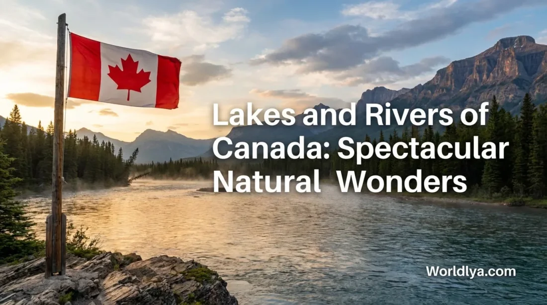
Canada is the kind of place where water feels like a main character. One minute you’re looking at a calm blue lake that mirrors the sky, the next you’re following a river that bends through forests, mountains, and wide-open plains. If you’ve ever wondered why Canada’s lakes and rivers look so unreal, or which ones are worth putting on your “someday” list, you’re in the right spot.
Key Information You Can Use Right Away
Fast Facts That Make Canada’s Water Feel Bigger
- Canada has more lake area than any other country.
- There are 563 lakes in Canada that are larger than 100 km².
- The Great Lakes (shared with the U.S.) hold about 18% of the world’s fresh lake water.
- The Mackenzie River system stretches about 4,241 km, making it Canada’s longest river system.
Quick gut-check: if you’re planning a trip, it’s totally normal to build your itinerary around water here. In many regions, lakes and rivers are the easiest way to understand the landscape.
Largest Freshwater Lakes Connected to Canada
Areas vary slightly by measurement method and rounding, so think of these as useful, real-world ranges.
| Lake | Approx. Area (km²) | Why It’s Famous |
|---|---|---|
| Lake Superior | 82,100–83,300 | One of the world’s largest freshwater lakes (shared border lake). |
| Lake Huron | 59,500–59,800 | Massive shoreline and island-filled waters (shared border lake). |
| Great Bear Lake | 30,200–31,792 | Largest lake entirely within Canada. |
| Lake Erie | 25,657–25,720 | Warm-season favorite for beaches and boating (shared border lake). |
| Lake Winnipeg | 24,387–24,600 | Big-sky vibes, long beaches, and a huge watershed. |
| Lake Ontario | 18,760–19,480 | Gateway lake that connects into the St. Lawrence system (shared border lake). |
| Lake Athabasca | 7,935–8,080 | A northern classic with a river-fed delta system nearby. |
Why Canada Has So Much Freshwater
Here’s the simple version: ice built a lot of Canada’s water story. Over long stretches of time, glaciers shaped basins, carved valleys, and left behind landscapes that naturally collect and move freshwater. Add wide plateaus, ancient rock, and big seasonal snowpacks in many regions, and you get a country that’s basically designed for lakes and river networks.
Another piece of the puzzle is the Canadian Shield—a huge area of exposed bedrock and thin soils. Bedrock doesn’t soak up water the way deep, spongey soils do. So rain and meltwater tend to pool, thread, and spread, creating countless lake basins and connected waterways.
A Handy Way to Think About It
Imagine Canada as a giant countertop with millions of tiny dips and a few huge bowls. Water collects in the dips (lakes), then slips off the countertop along grooves (rivers) until it reaches the “edges” (the oceans and big bays).
Legendary Lakes Worth Knowing
Canada has more spectacular lakes than any single list can hold. Still, a few stand out because they’re massive, iconic, or simply perfect for visitors. Think of this section like a starter pack—names you’ll keep seeing on maps, travel guides, and nature documentaries.
The Great Lakes: Freshwater on a Grand Scale
The Great Lakes—Superior, Huron, Erie, and Ontario on the Canadian side—are the closest thing to inland seas. On some shores, you can watch waves roll in and think, Is this really a lake? It is. And it’s part of a system that holds a remarkable share of the planet’s fresh lake water.
- Best for: road trips, waterfront cities, beaches, lighthouses, boat tours
- Look for: long coastal-style walks, sandy stretches, and sunsets that feel ocean-sized
Great Bear Lake: A Northern Giant
If you like superlatives, here’s a big one: Great Bear Lake is the largest lake entirely within Canada. It sits in the Northwest Territories and feels wonderfully remote on a map—like the kind of place you zoom into just to appreciate how huge “north” really is. It’s a reminder that Canada’s best water views aren’t only near major cities.
Lake Winnipeg: Big Sky, Big Water
Lake Winnipeg is a favorite for wide horizons and long, relaxing shorelines. It’s also a lake that surprises people: it’s considered one of the larger freshwater lakes on Earth, it stretches about 436 km from south to north, and it’s known for being shallow compared to its footprint. That combo creates classic “endless lake” scenery that’s easy to love.
Rocky Mountain Lakes: Small, Famous, and Unreal
Canada also has postcard lakes that aren’t massive at all—they’re famous because they’re dramatic. Alpine lakes in the Rockies (think places like Lake Louise and Maligne Lake) deliver that “how is this color real?” feeling. Glacial silt can scatter light in a way that makes the water glow turquoise on sunny days.
A Quick “Pick Your Lake Mood” Guide
- Want scale? Choose a Great Lake shoreline.
- Want quiet? Look for canoe-country lakes in forest regions.
- Want jaw-dropping photos? Aim for alpine lakes in the Rockies.
- Want “big lake energy” with wide beaches? Put Lake Winnipeg on your radar.
Rivers That Shape the Landscape
Rivers are Canada’s moving corridors—linking mountains to plains, forests to bays, and lakes to oceans. Some are famous because they’re long. Others are famous because they’re beautiful in a way that sticks with you for years. Either way, once you start noticing rivers on a map, Canada suddenly makes more sense.
Mackenzie River System: Canada’s Longest
The Mackenzie River system is the heavyweight: roughly 4,241 km when you count its major connected tributaries. The basin itself is enormous—on the order of 1.8 million km², which is roughly a fifth of Canada’s landmass. That’s the kind of number that makes you pause and re-read it once.
St. Lawrence River System: The Great Lakes’ Exit Route
The St. Lawrence is a true “system river.” Together with the Great Lakes, it forms a water route that reaches about 3,058 km into North America. The river section flowing out of Lake Ontario is often described as roughly 1,197 km long. Translation: it’s a major freshwater pathway with a lot of scenery packed along its course.
Fraser River: British Columbia’s Iconic Flow
The Fraser River is the longest river within British Columbia at about 1,375 km. It begins in the Rockies and travels to the coast near Vancouver. If you want a river that shows how quickly landscapes can change—from mountain headwaters to wide lower reaches—the Fraser is a great example.
Yukon River: A Legendary Northern Route
The Yukon River is often listed around 3,000 km in length (partly in Canada). Even on a simple map, it reads like a long, sweeping signature across the North—one that invites curiosity and daydreaming.
| River (or River System) | Approx. Length | Quick Snapshot |
|---|---|---|
| Mackenzie River System | 4,241 km | Canada’s longest river system; drains a huge northern basin. |
| St. Lawrence (System Length) | 3,060 km | Connects the Great Lakes to the Atlantic via a major river-and-estuary route. |
| Yukon River | ~3,000 km | A famous northern river that extends beyond Canada. |
| Fraser River | 1,375 km | British Columbia’s longest river; mountain-to-coast storyline. |
Where Canada’s Water Goes
All those lakes and rivers don’t just sit there looking pretty. They connect into giant drainage areas—like a country-sized set of funnels. In Canada, freshwater flows into five major continental watersheds:
- Pacific
- Arctic
- Atlantic
- Hudson Bay
- Gulf of Mexico (via connected river networks)
A Fun Map Trick
Next time you look at a map, pick a lake you recognize and ask: Where does this water eventually end up? Follow the outflow river, then the next one, then the next. You’ll start seeing Canada as a set of connected pathways instead of separate regions.
Easy Experiences for Every Travel Style
You don’t need a wilderness expedition to enjoy Canada’s waters. You just need the right match for your style. Pick one option and make it your theme for the day.
- City-friendly waterfront time: grab a coffee, walk a lakeside path, and watch boats come and go. Simple, satisfying.
- Beach day energy: bring a towel, snacks, and a book. Lakes can feel like oceans without the salt.
- Paddle-light adventure: a short canoe or kayak rental on calm water is often the easiest “Canada” moment you can create.
- Scenic drive + viewpoint combo: many famous lakes have designated lookouts where the view does the heavy lifting.
- Photo hunt: aim for early morning when the water is calmer and reflections look like a mirror.
Low-Effort Ways to Make the Day Memorable
- Bring one “slow” activity: a sketchbook, a journal, a playlist, or a paperback.
- Eat near the water: even a basic sandwich tastes better with a shoreline view.
- Stay for the light shift: late afternoon often turns lakes into gold.
Planning Checklist for a Smooth Day on the Water
Water days are fun because they feel spontaneous. Still, the best ones have a tiny bit of planning behind them. This checklist keeps it easy.
- Choose your water type: calm lake, wide river, or a shoreline you can stroll.
- Check local conditions: wind matters on big lakes; water levels and flow matter on rivers.
- Pack the basics: water, sun protection, a light layer, and a small snack.
- If you’re paddling: wear a properly fitted life jacket and keep your route within your comfort level.
- Keep it pristine: take your trash with you, and leave the shoreline looking untouched.
Pro tip: If you’re torn between a lake and a river, pick a place where you can see both—many regions have lake-and-river systems close together. You get variety without extra driving.
Quick FAQs
What’s the easiest “wow” lake experience for first-time visitors?
A Great Lake shoreline is hard to beat for scale, and alpine lakes in the Rockies are famous for color. If you want the simplest plan: choose a viewpoint lake where access is straightforward, arrive early, and stay long enough to see the light change.
Are the Great Lakes really lakes, not seas?
They’re lakes—freshwater lakes—but they can behave like small seas because of their size. That’s why wind and waves can matter so much on shoreline days.
Which name should I remember if I want “the biggest lake entirely in Canada”?
Great Bear Lake. It’s a standout for sheer size while staying fully within Canada’s borders.
What’s a simple way to understand Canadian geography through water?
Think in watersheds. Pick a lake or river, then trace where the water flows next. You’ll start seeing how regions connect—often across huge distances—through natural drainage networks.
References
- Environment and Climate Change Canada — Water sources: lakes
- Environment and Climate Change Canada — Water sources: rivers
- Canada Water Agency — Mackenzie River Basin overview
- Canada Water Agency — Lake Winnipeg basin: overview
- Natural Resources Canada — Atlas of Canada: Land and water (watersheds)
- The Canadian Encyclopedia — Great Bear Lake
More from Canada Guide
- Canada Government Structure: A Simple Overview
- Tourist Attractions in Canada: Niagara Falls and Beyond
- Travel Safety in Canada: Tips for International Visitors
- Canada Population: Regions and Demographics
- Universities in Canada: Campus Life and Academic Culture
- Education System in Canada: Primary and Secondary Schools