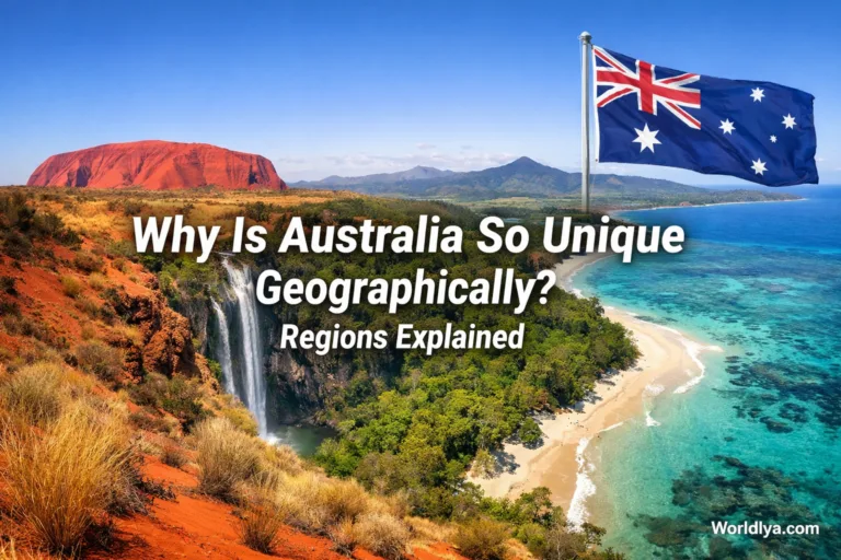
The Outback is the part of Australia that feels bigger than the map. It is not one state, one desert, or one neat tourist zone. It is a wide inland and remote Australia made of rangelands, desert country, savanna, grassland, small towns, cattle stations, mining towns, sacred landscapes, long roads, and quiet horizons. People often picture red sand and a single road fading into heat shimmer. That picture is partly true. It is also far too small.
To understand the Outback, think of Australia as a house with most daily life gathered near the edges. Sydney, Melbourne, Brisbane, Perth, Adelaide, and many other large places sit near the coast. The Outback is much of the inland room behind them: open, dry in many parts, lightly populated, and deeply tied to Australia’s natural identity.
The Simple Meaning of the Outback
The Outback means remote inland Australia, but there is no single official line where it begins. It is more of a lived idea than a border on a classroom map. Australians may use the word for places that are far from large cities, far from dense services, and shaped by distance, dry seasons, open land, and small communities.
A practical way to read the term is this: the Outback is where distance becomes part of daily life. Roads stretch for hours. Weather matters. Water matters. Local knowledge matters. The landscape does not rush to meet you; you slow down to understand it.
Where the Outback Is
The Outback reaches across large parts of the Northern Territory, Western Australia, South Australia, Queensland, and inland New South Wales. It also touches the way people describe remote parts of other regions. The word does not always follow state borders. It follows distance, dryness, road access, settlement patterns, and landscape character.
The Australian Government describes about 81% of Australia as rangelands, and notes that this broad part of the country is known to most Australians as the Outback. That does not mean every part looks like a red desert. Rangelands include tropical savannas, woodlands, shrublands, grasslands, arid zones, and semi-arid zones.
So, if someone asks “Where is the Outback?” the cleanest answer is: mostly inland and remote Australia, especially the rangeland regions away from the large coastal cities.
Places People Often Connect With the Outback
- Alice Springs and Central Australia
- Uluru-Kata Tjuta region in the Northern Territory
- The Kimberley in Western Australia
- The Pilbara in Western Australia
- Coober Pedy in South Australia
- Birdsville in Queensland
- Broken Hill in inland New South Wales
- The Nullarbor region across South Australia and Western Australia
These places are not identical. Some feel dusty and dry. Some have gorges, spinifex, rivers, plains, rocky ranges, or tropical wet-season rhythms. That variety is one reason the Outback keeps people curious.
What the Outback Is Not
The Outback is easy to misunderstand because films, postcards, and travel ads often repeat the same red-road image. Useful? Yes. Complete? Not really.
Not Only Desert
Australia’s mainland deserts cover about 18% of the mainland. The Outback is wider than that. It includes desert regions, but also savanna, grassland, rocky ranges, floodplains, and dry woodland.
That is why the Outback should not be imagined as one single desert. It overlaps with well-known dry regions such as the Simpson Desert, the Great Victoria Desert, and the Great Sandy Desert, but it is broader than all of them. A simple way to see the difference is to compare it with something like [Sahara vs Australian Outback]: one is a clearly defined desert, while the other is a much wider idea shaped by distance, remote life, landscapes, and how people interact with inland Australia.
Not Empty Land
The Outback may look empty from a highway, but it is full of meaning: communities, working properties, protected areas, animal habitats, water systems, travel routes, and places of deep cultural value.
Not One Climate
Central Australia is mainly desert. Northern Outback regions may have wet and dry seasons. Some areas are hot for much of the year; others can feel surprisingly cold at night.
Not Cut Off From Life
People live, work, raise families, run businesses, welcome visitors, care for Country, and manage land across remote Australia. The pace is different, not lesser.
A Cleaner Way to Picture the Outback
Imagine three layers sitting on top of one another.
- Distance: towns and services are far apart.
- Climate: many areas have low or variable rainfall.
- Land Use and Culture: the land holds natural, cultural, pastoral, tourism, and resource value.
When those three layers meet, you are close to the everyday meaning of the Outback. It is not just scenery. It is a way distance shapes land, travel, work, weather, and community.
Outback Australia by the Numbers
| Topic | Useful Figure | What It Means for Readers |
|---|---|---|
| Rangelands | About 81% of Australia is broadly defined as rangelands. | The Outback idea covers a very large share of the country, not just one famous red-dirt area. |
| Arid and Semi-Arid Land | About 70% of Australia is arid or semi-arid. | Dryness and variable rainfall explain much of the Outback’s look, travel rhythm, and settlement pattern. |
| Mainland Deserts | Australia’s 10 largest mainland deserts total about 1,371,000 km², or 18% of the mainland. | Deserts matter, but the Outback is not only desert. |
| Great Artesian Basin | It lies below parts of Queensland, South Australia, New South Wales, and the Northern Territory. | Groundwater helps explain how people, towns, stations, and ecosystems exist across dry inland areas. |
| Remoteness | Australia’s national statistics classify areas by access to services, using categories such as Remote and Very Remote. | “Remote” is not just a feeling; it can be measured through distance to service centres. |
Why the Outback Looks So Dry
Much of inland Australia sits in dry climate zones. The Bureau of Meteorology describes the Red Centre as mainly desert, while the central desert zone is surrounded by grassland. Dry air, high pressure patterns, distance from moist coastal systems, and variable seasonal rain all shape the inland.
Rain can still arrive with force. A dry creek can become a moving sheet of water after heavy rain. A dusty road can become soft, closed, or slow. This is one of the Outback’s quiet lessons: dry does not mean simple.
In northern Outback regions, the year may be read through wet and dry seasons rather than four neat seasons. In Central Australia, summer heat can be strong, while winter nights may surprise visitors. The land teaches you not to guess.
The Outback Is a Place of Distance
Distance is one of the most honest ways to understand the Outback. In a city, a short drive may take you past shops, fuel, clinics, stations, and cafés. In remote Australia, a road sign might name a town hundreds of kilometres away. That changes how people plan.
For visitors, this means the Outback rewards preparation. It is not a place to treat like a casual city detour. Maps, fuel, water, road reports, weather checks, spare tyres, and local advice are part of the experience. Planning is not boring here. It is how the trip becomes relaxed.
A Helpful Travel Mindset
In the Outback, distance is not an inconvenience. It is part of the place. Give it room. Build slower days. Check conditions. Ask local visitor centres, park offices, roadhouses, or accommodation staff before taking remote routes. A better trip often starts with fewer assumptions.
Why the Outback Matters to Australia
The Outback matters because it shapes how Australia is seen, studied, travelled, and lived. It is more than a postcard background. It affects water, biodiversity, food production, tourism, culture, science, and the way people understand the scale of the country.
It Explains Australia’s Size
Australia is a large country with a coastal population pattern. The Outback helps explain why that pattern exists. Inland areas can be dry, remote, and demanding to service. That does not make them less valuable. It makes them different.
When people first see an Outback road map, they often understand Australia in a new way. The space between dots matters as much as the dots themselves.
It Holds Cultural Meaning
The Outback includes Country cared for and known by First Nations peoples. Many places have cultural stories, responsibilities, names, and local guidance that visitors should respect. A good visitor does not treat the landscape like a blank stage. They pay attention to signs, guided information, access rules, and the wishes of Traditional Custodians.
This respectful approach makes travel better. You notice more. You move with more care. You understand that a rock formation, waterhole, track, or range may carry meaning that is not visible at first glance.
It Supports Unique Ecosystems
Outback landscapes can look tough, but many are finely balanced. Spinifex grasslands, mulga woodlands, desert oaks, saltbush plains, waterholes, wetlands, savannas, and rocky ranges support plants and animals adapted to heat, dryness, fire, flood, and long gaps between rain.
Some species hide during the heat. Some bloom after rain. Some follow water. The Outback is full of quiet timing. Blink at the wrong season and you may miss the show.
It Shows How Valuable Water Is
In the Outback, water is not background detail. It is the main character in many stories. Natural springs, creeks, waterholes, bores, rain tanks, and groundwater systems help explain where towns developed, where animals gather, and how people travel.
The Great Artesian Basin, Australia’s largest groundwater basin, lies beneath parts of inland eastern and central Australia. It is one reason dry inland areas can support communities and activity across huge distances.
It Shapes Travel in Australia
Many visitors come to Australia for beaches, reefs, and cities. The Outback adds another kind of travel: open-road journeys, star-filled nights, guided walks, old railway towns, desert parks, gorges, art centres, roadhouses, and landscapes that make silence feel physical.
It is not a place to rush through just to tick off a photo. The best Outback travel often feels slower. A sunrise. A lookout. A chat at a roadhouse. A short walk that reveals flowers after rain. Small moments carry weight here.
Common Outback Landscapes
The Outback is not one scene repeated. It changes by region, season, elevation, soil, and rainfall. Here are some landscape types that help make sense of it.
| Landscape Type | What You Might Notice | Why It Matters |
|---|---|---|
| Red Desert Country | Sand plains, dunes, spinifex, salt lakes, wide skies | It gives the classic Outback image, especially in Central Australia. |
| Savanna | Eucalypt woodland, grasses, wet and dry season changes | It shows that northern Outback areas can be tropical, not only dry desert. |
| Rocky Ranges and Gorges | Cliffs, waterholes, shaded walks, layered stone | These places reveal geology, water movement, and long landscape history. |
| Grasslands and Plains | Open country, low vegetation, big weather views | They support pastoral activity and many adapted plants and animals. |
| Remote Towns and Roadhouses | Fuel stops, local services, visitor information, community life | They make long-distance travel possible and show the human side of the Outback. |
Outback Towns Are Small but Not Simple
Remote towns can be easy to underestimate. A town may look small on a map, yet it may serve a huge surrounding area. It might support travellers, nearby stations, local families, transport workers, park staff, artists, health services, schools, tourism operators, and regional businesses.
That is why a roadhouse can feel like more than a fuel stop. It may be a rest point, news point, repair contact, lunch counter, noticeboard, and weather update all in one. In a city, these roles are spread across many places. In the Outback, they may sit under one roof.
Wildlife and Plants in the Outback
Outback life is often subtle. It does not always pose for visitors. Many animals avoid the hottest part of the day. Tracks in sand, bird calls at dawn, movement near water, and small changes in vegetation can say more than a quick glance.
Plants Built for Dry Country
Plants such as spinifex, mulga, desert oak, saltbush, and many hardy grasses survive by managing water carefully. Some have narrow leaves. Some grow slowly. Some wait for rain and then flower fast, as if the whole landscape has suddenly remembered colour.
Animals That Follow Shade, Water, and Time
Kangaroos, wallabies, emus, reptiles, birds of prey, parrots, small mammals, and many insects are part of different Outback regions. You may see more wildlife early or late in the day. Around water, the land can feel busy even when the wider plain looks still.
Good wildlife watching in the Outback is patient. It is less like scrolling and more like listening.
How the Outback Changes With the Seasons
Season matters. A place that feels dry and bare in one month may show fresh growth after rain. Roads that seem easy in dry weather may close after flooding. A walking trail that feels pleasant in winter may be uncomfortable in summer heat.
- Central regions: often have hot summers, cooler winters, and large day-night temperature shifts.
- Northern regions: often follow wet and dry season patterns.
- Desert areas: can change quickly after rain, with wildflowers, temporary water, and animal activity.
- Remote roads: may be affected by weather, especially unsealed routes.
For travel planning, the best season depends on the region. Many visitors prefer cooler months for Central Australia. Northern routes often need careful checking during the wet season. The safest habit is simple: check the region, not just the country.
Why Visitors Should Not Treat the Outback Like a Theme Park
The Outback welcomes careful visitors, but it asks for respect. It is real country with real distances, working properties, cultural places, protected areas, changing weather, and limited services. That is not a warning to stay away. It is a reminder to travel well.
A Sensible Outback Travel Checklist
- Check official road conditions before remote drives.
- Carry more water than you think you need.
- Plan fuel stops before leaving larger towns.
- Tell someone your route and expected arrival time.
- Respect signs, closures, access rules, and cultural guidance.
- Do not rely only on mobile reception in remote areas.
- Slow down on unsealed roads and after weather changes.
- Ask local staff about current conditions; local knowledge can save a day.
The Difference Between the Bush and the Outback
People sometimes use “bush” and “Outback” as if they mean the same thing. They overlap, but they are not identical.
The bush often means rural or natural country outside the city. It can be forest, farmland, scrubland, or regional countryside. It may be close to towns and services.
The Outback usually suggests more remote, more inland, more open, and often drier country. If “the bush” is outside the city, the Outback is farther out again.
A simple comparison: the bush may be a weekend away. The Outback may ask you to plan the fuel, water, route, weather, and return.
Why the Outback Stays in People’s Memory
Many places are beautiful. The Outback is memorable for another reason too: it changes your sense of scale. A hill may sit alone for kilometres. A road may look straight enough to stitch the horizon. A night sky may feel close enough to touch.
That space can make small things stand out. A water tank. A wedge-tailed eagle. A line of trees marking a creek. A town sign. A shaded table outside a roadhouse. The Outback does not always shout for attention. It often waits until you are quiet enough to notice.
The Outback matters because it is not just far away. It is where distance, land, water, culture, and daily life meet in a way that feels distinctly Australian.
Common Questions About the Outback
Is the Outback a Desert?
Partly. Some Outback regions are desert or semi-arid, but the Outback also includes savanna, grassland, shrubland, rocky ranges, wetlands, small towns, and pastoral country. Calling it “the desert” misses much of its variety.
Does Anyone Live in the Outback?
Yes. The population is sparse compared with coastal cities, but people live across remote Australia in towns, communities, stations, mining centres, service hubs, and tourism areas. Some places are small in population but large in regional role.
Why Is the Outback So Famous?
It is famous because it gives Australia one of its most recognisable landscape identities: open space, red earth, big skies, long roads, ancient-looking rock forms, and strong links between land, culture, travel, and endurance.
Can Tourists Visit the Outback?
Yes. Many Outback regions welcome visitors through national parks, guided tours, cultural experiences, scenic drives, museums, lookouts, walking trails, and town stays. Good planning matters, especially for remote routes and hot seasons.
What Is the Best Way to Understand the Outback?
Start with distance, then add climate, water, culture, and local knowledge. The Outback is not just a place you look at. It is a place you read slowly.
Final Thought
The Outback is Australia beyond the easy edges. It is dry in many places, but not lifeless. Remote, but not empty. Famous, but often misunderstood. To explain it well, you need more than a red-dirt image. You need distance, water, climate, people, culture, plants, animals, roads, and time. Once those pieces come together, the Outback starts to make sense: not as a single destination, but as one of the main ways Australia shows its size and character.
Sources
- Australian Government Department of Climate Change, Energy, the Environment and Water — Outback Australia: The Rangelands
- Geoscience Australia — Areas of Australian and Territory Deserts
- Sahara vs Australian Outback – Desert Comparison Guide
- Bureau of Meteorology — Australian Climate Zones
- Australian Bureau of Statistics — Remoteness Areas
- Australian Government Department of Climate Change, Energy, the Environment and Water — Great Artesian Basin
- Northern Territory Police, Fire and Emergency Services — Personal Safety