
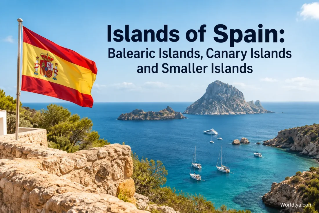
Spain’s islands are not one single type of destination. The Balearic Islands sit in the Mediterranean Sea east of mainland Spain, where limestone coves, pine-covered slopes, compact historic towns and clear blue water shape much of the scenery. Far to the southwest, the Canary Islands rise from the Atlantic with volcanic peaks, black-sand shores, dune fields, laurel forests and mild weather through much of the year. Spain also has smaller islands scattered along its Mediterranean and Atlantic coasts, several of them protected for their marine life, bird habitats and unusual landscapes.
That variety matters when choosing an island. Mallorca can combine a city break, mountain villages and beaches in one trip. La Gomera is much more focused on walking and forested valleys. Formentera works on a compact scale where bicycles and short road journeys make sense, while Tenerife can move from subtropical coastline to high volcanic terrain in a single day.
How Spain’s Island Geography Fits Together
- Balearic Islands: Mallorca, Menorca, Ibiza and Formentera are the four main inhabited islands, accompanied by smaller islands and islets such as Cabrera and Sa Dragonera.
- Canary Islands: Tenerife, Gran Canaria, Lanzarote, Fuerteventura, La Palma, La Gomera, El Hierro and La Graciosa form Spain’s main Atlantic island group.
- Atlantic Islands of Galicia: the protected Cíes, Ons, Sálvora and Cortegada archipelagos lie off northwestern Spain.
- Other Mediterranean islands: examples include Tabarca off Alicante, along with many smaller coastal islands and islets.
| Island Group | Setting | Landscape Character | Especially Suited To |
|---|---|---|---|
| Balearic Islands | Mediterranean Sea | Coves, sandy beaches, limestone coast, pine woodland and mountain scenery | Beach holidays, village visits, sailing, cycling and mixed city-and-coast trips |
| Canary Islands | Atlantic Ocean | Volcanoes, cliffs, dunes, forests, lava terrain and natural pools | Year-round outdoor trips, hiking, beaches, water sports and volcanic scenery |
| Galician Atlantic Islands | Atlantic coast of Galicia | Dunes, cliffs, beaches, coastal woodland and marine habitats | Protected nature, walking, birdlife and seasonal boat excursions |
| Smaller Mediterranean Islands | Eastern and southeastern Spanish coast | Compact islands, coves and protected marine areas | Day trips, swimming, walking and slower coastal experiences |
Balearic Islands: Mediterranean Coves, Mountains and Island Towns
The Balearics offer the most recognizably Mediterranean side of island Spain. Expect pale stone, pine trees, dry-stone landscapes, sheltered coves and towns where the sea is rarely far away. Yet the four main islands are not interchangeable. Mallorca has the broadest mix, Menorca gives nature and archaeology more room, Ibiza combines rural and coastal landscapes with a lively cultural scene, and Formentera pares the experience down to beaches, small settlements and short distances.
Mallorca: The Island With the Widest Mix
Mallorca, also written as Majorca in English, is the largest Balearic island. Its scale is one reason it works for travellers who do not want to choose between beach, mountains, villages and a city. Palma provides the urban side of the island with pedestrian streets, historic architecture, markets, museums and a long waterfront. Leave the capital and the island changes quickly.
The northwest is dominated by the Serra de Tramuntana, where roads curve through steep terrain and villages such as Valldemossa, Deià and Sóller sit between stone terraces and mountain slopes. This part of Mallorca feels very different from the flatter beach districts elsewhere on the island. Walkers and cyclists often focus on this side because the landscape gives each route a strong sense of place.
The coast adds another layer. Mallorca has broad sandy beaches, narrow coves, natural harbours, rocky headlands and areas where pine woodland reaches close to the sea. A week here does not have to feel like seven versions of the same beach day. One morning can begin in Palma, another among the mountains, and another beside a small eastern cove.
- Choose Mallorca for: variety, first-time Balearic trips, road trips and city-plus-beach holidays.
- Look toward: Palma for culture and city life; the Tramuntana range for mountains; the east and southeast for numerous coves; the north for broad bays and coastal scenery.
- Allow enough time: distances are manageable, but the island rewards travellers who avoid trying to cross from one corner to another every day.
Menorca: Coves, Footpaths and Open Landscapes
Menorca is smaller than Mallorca and has a noticeably different rhythm. Its coastline stretches for more than 200 kilometres and changes character between north and south. The north tends toward darker, redder and more rugged scenery, while many southern coves are backed by pine trees and pale rock.
The island is a UNESCO Biosphere Reserve, and that protected character is visible beyond the beaches. Wetlands, rural fields and walking routes are part of the experience. The Camí de Cavalls, a historic route circling the island, has become one of the clearest ways to understand how beaches, farmland, cliffs and woodland connect.
Menorca also stands out for its prehistoric heritage. Talayotic sites, stone structures and archaeological remains appear across the island rather than being concentrated in a single museum district. In 2023, the Talayotic Menorca sites received UNESCO World Heritage status, adding another reason to explore inland instead of treating Menorca only as a beach destination.
For an urban contrast, Maó and Ciutadella provide two distinct bases. Maó overlooks an extensive natural harbour, while Ciutadella has a compact historic centre and a small harbour edged by restaurants and walking routes.
Ibiza: More Than Its Famous Evening Scene
Ibiza has one of Spain’s most recognizable island names, yet its quieter side occupies much of the map. Pine-covered hills, whitewashed villages, coastal paths, coves and agricultural areas stretch well beyond the island’s busiest resort districts.
The historic upper town of Dalt Vila rises above Ibiza Town and forms part of the island’s UNESCO-listed cultural and natural heritage. Narrow lanes, viewpoints, galleries and old stone buildings make the centre worth visiting even for travellers whose main interest is the coast.
Elsewhere, Ibiza becomes more rural. Santa Gertrudis de Fruitera and Sant Carles de Peralta show a village-based side of the island, while coastal areas range from sandy beaches to small coves tucked beneath low cliffs. The island is compact enough to mix several settings in the same stay without constantly changing accommodation.
Ibiza works particularly well when you want contrast. You can spend part of a day among the lanes of Ibiza Town, move inland for village cafés and local markets, then finish beside the Mediterranean without travelling far.
Formentera: Small Scale and Clear Water
Formentera has no airport, so arrival is by sea, most commonly from neighbouring Ibiza. Regular crossings link Ibiza with La Savina, Formentera’s port, and the short sea journey immediately gives the island a more self-contained feeling.
The island is known for pale sand, turquoise water, dunes, juniper and pine vegetation, salt-pan landscapes and low-rise settlements. Distances are short. Cycling, walking and compact road trips therefore make more sense here than ambitious sightseeing schedules.
Ses Illetes is the most widely known beach area, but Formentera has several different coastal settings. Cala Saona forms a small cove on the west, while Migjorn runs along much of the southern side. Inland villages such as Sant Francesc Xavier and El Pilar de la Mola offer an easy break from the beach.
Cabrera: A Protected Island South of Mallorca
Cabrera is not a resort alternative to Mallorca. It belongs to a protected archipelago south of Mallorca and forms part of the Cabrera Archipelago Maritime-Terrestrial National Park. Most of the protected area is marine, which is why the experience is shaped as much by the surrounding sea as by the island itself.
Visitors arrive by boat, including authorized passenger services from Mallorca. Walking routes, coastal views and clear water are the focus. Because access, navigation, mooring and some activities are managed within a national park, checking current park arrangements before travelling is particularly useful here.
Canary Islands: Volcanoes, Forests and Atlantic Beaches
The Canary Islands sit in the Atlantic Ocean and are volcanic in origin. Their landscapes can shift dramatically over short distances. Dry coastal zones may sit within driving distance of pine forests, cloud-influenced woodland or high mountain terrain. That variation is one reason the Canaries suit travellers who want more than a conventional beach trip.
There are eight main Canary Islands: Tenerife, Gran Canaria, Lanzarote, Fuerteventura, La Palma, La Gomera, El Hierro and La Graciosa. Tenerife and Gran Canaria have the widest range of large-scale transport and visitor services. The smaller western islands feel more nature-led, while Lanzarote and Fuerteventura offer some of the archipelago’s most distinctive dry and open landscapes.
Tenerife: From Atlantic Shore To Mount Teide
Tenerife is the largest Canary Island and contains Mount Teide, Spain’s highest mountain. Teide National Park places high-altitude volcanic terrain at the centre of the island, creating a visual contrast with the beaches and coastal towns below.
The north and south can feel quite different. Southern Tenerife has many established beach areas and a generally drier appearance. The north is greener in many places, with towns such as La Orotava and Puerto de la Cruz sitting beneath steep slopes. San Cristóbal de La Laguna adds a walkable historic centre and UNESCO World Heritage status.
Tenerife is a strong choice for travellers who want one island with several landscape zones. Beach time, pine forests, volcanic viewpoints, historic streets and high mountain scenery can all fit into the same trip.
Gran Canaria: City, Dunes and Mountain Interior
Gran Canaria packs unusually varied scenery into a roughly circular island. Las Palmas de Gran Canaria offers a genuine city experience with the long urban beach of Las Canteras, while the south is better known for beach resorts and the dunes of Maspalomas.
Drive inland and the scenery changes again. Ravines, mountain roads and villages such as Tejeda replace the coastal feel. This is why Gran Canaria makes sense for travellers who like to alternate easy beach days with road trips rather than staying beside the water throughout their visit.
Lanzarote: Lava Terrain and César Manrique’s Island Vision
Lanzarote has a visual identity that is difficult to confuse with another Spanish island. Black and reddish volcanic terrain, low white buildings and broad open views dominate much of the landscape.
Timanfaya National Park is the most familiar volcanic area, yet the island’s geology appears far beyond the park boundary. In La Geria, vines grow in individual hollows protected by curved stone walls, creating one of Spain’s most recognizable wine landscapes.
The work of Lanzarote-born artist and designer César Manrique is also closely tied to the island. Places associated with him use caves, lava formations, viewpoints and architecture in ways that keep the volcanic setting visible rather than hiding it behind conventional development.
Fuerteventura: Long Beaches and Open Horizons
Fuerteventura is shaped by space. Long sandy beaches, broad plains, low volcanic hills and a generally open landscape give it a different feeling from steeper islands such as Tenerife or La Gomera.
The dunes and beaches around Corralejo define part of the north, while the Jandía peninsula stretches into the south. Wind also plays a strong role in the island’s outdoor identity, helping make Fuerteventura popular for surfing, windsurfing and other water sports.
Travellers who mainly want sand, sea and room to move often find Fuerteventura easier to understand than the more densely varied islands. The landscape is less about constant sightseeing and more about choosing a coast, stopping at viewpoints and spending time outdoors.
La Palma: Steep Landscapes, Forests and High Viewpoints
La Palma is one of the greener Canary Islands. Deep ravines, volcanic ridges, pine forests and black-sand coastal areas occupy a relatively compact island where elevation changes quickly.
Caldera de Taburiente National Park is the centrepiece for many walking trips. Higher still, the Roque de los Muchachos area rises above much of the island and is known for mountain views and astronomical observation. Clear skies and high elevation have made La Palma one of Spain’s leading stargazing destinations.
This is an island for travellers comfortable with winding roads and vertical landscapes. A short distance on the map can involve a much longer journey once ravines and mountain slopes enter the equation.
La Gomera: Laurel Forests and Walking Trails
La Gomera is much smaller than Tenerife, which lies nearby, yet the terrain is deeply cut by valleys and ravines. The island’s most distinctive environment is Garajonay National Park, where humid laurel forest survives under moisture carried by Atlantic clouds.
Walking is central to a visit here. Roads reach many villages and viewpoints, but trails reveal the changes in vegetation and elevation more clearly. Valle Gran Rey, Agulo, Hermigua and the island capital of San Sebastián de La Gomera can all form useful points around a wider nature-focused trip.
La Gomera is also associated with Silbo Gomero, a whistled communication tradition recognized by UNESCO as Intangible Cultural Heritage. It is one of the clearest examples of an island landscape shaping a cultural practice.
El Hierro: Natural Pools and a Slower Atlantic Scale
El Hierro is the smallest of the Canary Islands with its own airport. Its landscape combines cliffs, volcanic formations, woodland, small settlements and natural swimming pools formed along the rocky coast.
The island attracts walkers, divers and visitors who prefer shorter roads and fewer large resort areas. Places such as Charco Azul and other coastal pools turn the volcanic shoreline into natural bathing spots, while inland roads lead through pine forest and higher viewpoints.
La Graciosa: Sand Roads North of Lanzarote
La Graciosa lies just north of Lanzarote and is reached by ferry between Órzola and Caleta de Sebo. The crossing takes around half an hour on regular services. Once ashore, the contrast with larger islands is immediate: roads are unpaved and motor traffic is restricted.
The island covers about 29 square kilometres and belongs to the protected Chinijo Archipelago area. Walking, cycling and authorized local transport are the practical ways to move around. Beaches such as La Francesa, La Cocina and Las Conchas are spread around a volcanic landscape with very little conventional urban development.
La Graciosa rewards simple plans. A beach, a bicycle route, lunch in Caleta de Sebo and plenty of time between them often fit the island better than a long checklist of stops.
Smaller Spanish Islands Beyond the Two Main Archipelagos
Spain’s island geography does not stop with the Balearics and Canaries. Smaller islands sit off Galicia, Valencia and other sections of the mainland coast. Many have stricter access arrangements because their ecosystems are protected, so they often work better as focused day trips than as conventional island holidays.
Cíes Islands: Protected Atlantic Scenery Off Galicia
The Cíes archipelago lies at the mouth of the Ría de Vigo in Galicia and forms part of the Atlantic Islands of Galicia Maritime-Terrestrial National Park. Beaches, dunes, cliffs and seabird habitat meet within a relatively small area.
Rodas Beach links the islands of Monteagudo and Faro with a curved strip of pale sand. From there, marked walking routes lead toward viewpoints and lighthouses. The setting feels very different from the dry Mediterranean islands: Galicia’s Atlantic light, cooler water, green slopes and exposed coastline give Cíes its own identity.
Visitor numbers are controlled. During the main high-season period, prior authorization from the Xunta de Galicia is required before purchasing regular passenger transport to Cíes. Outside that period, public access arrangements differ, so the national park’s current visitor information should be checked before making transport plans.
Ons: A Lived-In Island Inside the Same National Park
Ons belongs to the same Galician national park but feels different from Cíes because it retains a resident community and a stronger lived-in island character. Footpaths cross the island between beaches, viewpoints and small settled areas, while cliffs and sea caves shape parts of the western coast.
Regular seasonal boats commonly operate from ports around the Ría de Pontevedra. As with Cíes, visitor numbers are managed and high-season visits require authorization under the current national park system.
Sálvora and Cortegada: Quieter Corners of Galicia’s Atlantic Park
Sálvora and Cortegada complete the four main archipelagos of the Atlantic Islands of Galicia National Park. They receive fewer casual visitors than Cíes and Ons, and trips are more closely tied to authorized boat services and park arrangements.
Cortegada lies in the sheltered waters of the Arousa estuary and is noted for woodland, while Sálvora sits farther toward the open Atlantic. Together they show how varied one national park can be: exposed islands, sheltered estuary environments, dunes, rocky coasts and marine habitats all occur within the same protected system.
Tabarca: A Tiny Inhabited Island Off Alicante
Tabarca lies off the coast of Alicante in southeastern Spain. Roughly 1.8 kilometres long, it is the only inhabited island of the Valencian Community and forms the largest part of a small archipelago.
The island can be reached by passenger boat, with services varying by season and departure port. Its compact size means a visit naturally combines the small settlement, waterfront, beaches, coves and walking routes without needing road transport.
The surrounding waters form a protected marine reserve, and seagrass habitats contribute to the area’s underwater life. Swimming and snorkelling are popular when sea conditions are suitable, while the island itself can be crossed on foot in a relatively short time.
Balearic or Canary Islands: Which Fits Your Trip?
The choice becomes easier once you decide what you actually want to do after breakfast. Do you picture a short drive to a Mediterranean cove, a mountain walk above the Atlantic, a city afternoon, a bicycle ride or a volcanic viewpoint? The answer points toward different islands.
| Travel Style | Islands To Consider | Why They Fit |
|---|---|---|
| First Island Trip To Spain | Mallorca, Tenerife, Gran Canaria | Large choice of landscapes, accommodation, transport and activities |
| Mediterranean Coves | Menorca, Mallorca, Formentera, Ibiza | Clear-water coves and compact coastal routes |
| Long Sandy Beaches | Fuerteventura, Menorca, Gran Canaria | Large sandy stretches and varied beach settings |
| Volcanic Landscapes | Lanzarote, Tenerife, La Palma | Lava terrain, volcanic peaks and national parks |
| Forest Walking | La Gomera, La Palma, Menorca | Marked routes through woodland and protected natural areas |
| Compact Slow Travel | Formentera, La Graciosa, El Hierro | Short distances and a smaller settlement pattern |
| City and Beach Combination | Mallorca, Gran Canaria, Tenerife | Palma, Las Palmas de Gran Canaria and Santa Cruz or La Laguna add urban variety |
| Protected Island Day Trip | Cabrera, Cíes, Ons, Tabarca | Boat access and nature-focused itineraries |
Island Hopping and Getting Around
Island hopping sounds simple on a map, but geography decides whether it is efficient. Nearby islands with frequent ferries can pair naturally. Others are far enough apart that flying saves a large part of a day.
Useful Balearic Island Pairs
- Ibiza and Formentera: the easiest pairing because Formentera depends on sea access and fast ferry crossings can take around 30 minutes.
- Mallorca and Menorca: regular sea links connect the islands, including services between Alcúdia and Ciutadella.
- Mallorca and Cabrera: suited to a focused national-park excursion rather than a conventional two-island hotel itinerary.
Useful Canary Island Pairs
- Lanzarote and La Graciosa: a natural pairing because La Graciosa is reached from Órzola in northern Lanzarote.
- Lanzarote and Fuerteventura: one of the shorter ferry links between the larger Canary Islands.
- Tenerife and La Gomera: frequent connections make it practical to combine Tenerife’s scale with La Gomera’s walking landscape.
- Tenerife and El Hierro: connected by sea and air, allowing a larger island and a quieter smaller island to share one itinerary.
Ferry schedules, departure ports and seasonal frequencies can change, especially on smaller-island routes. Checking the current sailing rather than relying on an old timetable prevents a simple island hop from turning into an awkward travel day.
When To Visit Spain’s Islands
The Balearics and Canaries should not be treated as if they share the same seasonal pattern. Their locations are too different.
| Season | Balearic Islands | Canary Islands |
|---|---|---|
| Spring | Comfortable for walking, cycling, villages and coastal exploration; sea temperatures rise as the season progresses | Mild conditions suit hiking, beaches and mixed outdoor trips |
| Summer | Main beach season with warm sea conditions and the widest range of seasonal visitor services | Warm and generally dry in many coastal areas, with local variation between islands and elevations |
| Autumn | Early autumn can retain warm sea conditions; later months become quieter and cooler | Continues to work well for beaches, walking and outdoor activities |
| Winter | Better suited to towns, walking, cycling and quieter coastal stays than a guaranteed hot beach holiday | Popular for mild Atlantic winter conditions, especially in lower coastal areas |
Altitude matters in the Canaries. A warm afternoon beside the sea does not tell you what conditions will feel like near Mount Teide or at a high viewpoint on La Palma. The Balearics have elevation changes too, especially in Mallorca, but their overall seasonal rhythm remains more recognizably Mediterranean.
How Many Islands Should You Combine?
More islands do not automatically create a better trip. Every ferry transfer brings check-in time, luggage handling and another journey to accommodation. On larger islands, staying put can reveal more variety than adding another destination.
One-Island Trips
Mallorca, Tenerife and Gran Canaria can easily fill a longer holiday by themselves. Each has enough landscape variation to divide a stay into several distinct areas.
Two-Island Trips
Pairs such as Ibiza and Formentera, Lanzarote and La Graciosa, or Tenerife and La Gomera work well because the islands offer clear contrasts without requiring an overly complicated route.
What Makes Spain’s Islands So Different From One Another?
Distance is only part of the explanation. Geology, rainfall, elevation and exposure to the sea have produced very different environments. The Balearics are largely associated with Mediterranean limestone landscapes, while volcanic processes dominate the Canaries. Galicia’s offshore islands belong to a cooler Atlantic setting where dunes, cliffs and coastal vegetation respond to a different climate again.
This diversity can be seen within the archipelagos themselves. Fuerteventura’s broad dry spaces bear little resemblance to the humid forest inside La Gomera. Northern Menorca differs from many of its southern coves. Mallorca’s mountains feel far removed from the flatter landscapes around some of its large bays.
That is why choosing “a Spanish island” is only the beginning. The more useful question is what kind of island landscape do you want to wake up to? A Mediterranean cove, a volcanic ridge, a long Atlantic beach, a laurel forest or a tiny harbour can all answer that question without leaving Spain.
Sources
- Spain Official Tourism Portal — Balearic Islands
- Spain Official Tourism Portal — Canary Islands
- Official Tourism Website of the Balearic Islands
- Spanish Ministry for Ecological Transition — Cabrera Archipelago National Park Visitor Information
- Galician Atlantic Islands Maritime-Terrestrial National Park — The Park
- Galician Atlantic Islands National Park — Passenger Boat and Visitor Authorization Information
- Alicante Municipal Tourism Board — Tabarca Island
- Spain Official Tourism Portal — Main Sea Connections and Inter-Island Ferries